
Center for Coastal Climate Resilience
Center for Coastal Climate Resilience, UC Santa Cruz
Since 2022 we have built the tools UC Santa Cruz's Center for Coastal Climate Resilience uses to develop and show its coastal resilience research.
Problem Statement
Coastal planners, insurers, and conservation funders need to know how much flood protection mangroves, reefs, and dunes actually provide, and how adaptation choices like seawalls or reef restoration change the outcome. That evidence lived in separate research models and raw model output, not in a form planners or the public could explore for themselves.
Collaboration
We have worked with UC Santa Cruz's Center for Coastal Climate Resilience since 2022, building the data pipelines and web tools behind its research. The center's scientists bring the flood, erosion, and habitat-benefit models; we turn that output into public tools coastal planners, funders, and the public can use directly.
Apps
Coastal Resilience Explorer
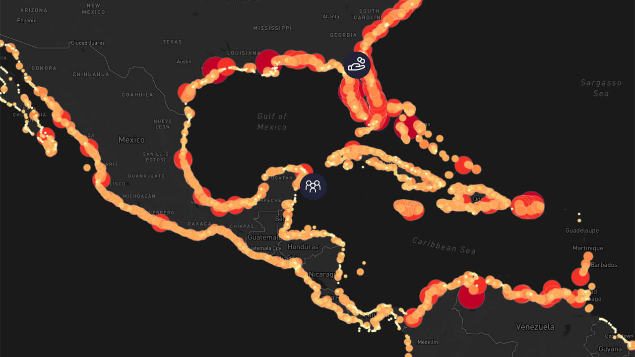
A public map of the global flood-protection value of mangroves and coral reefs.
NbS Adapts
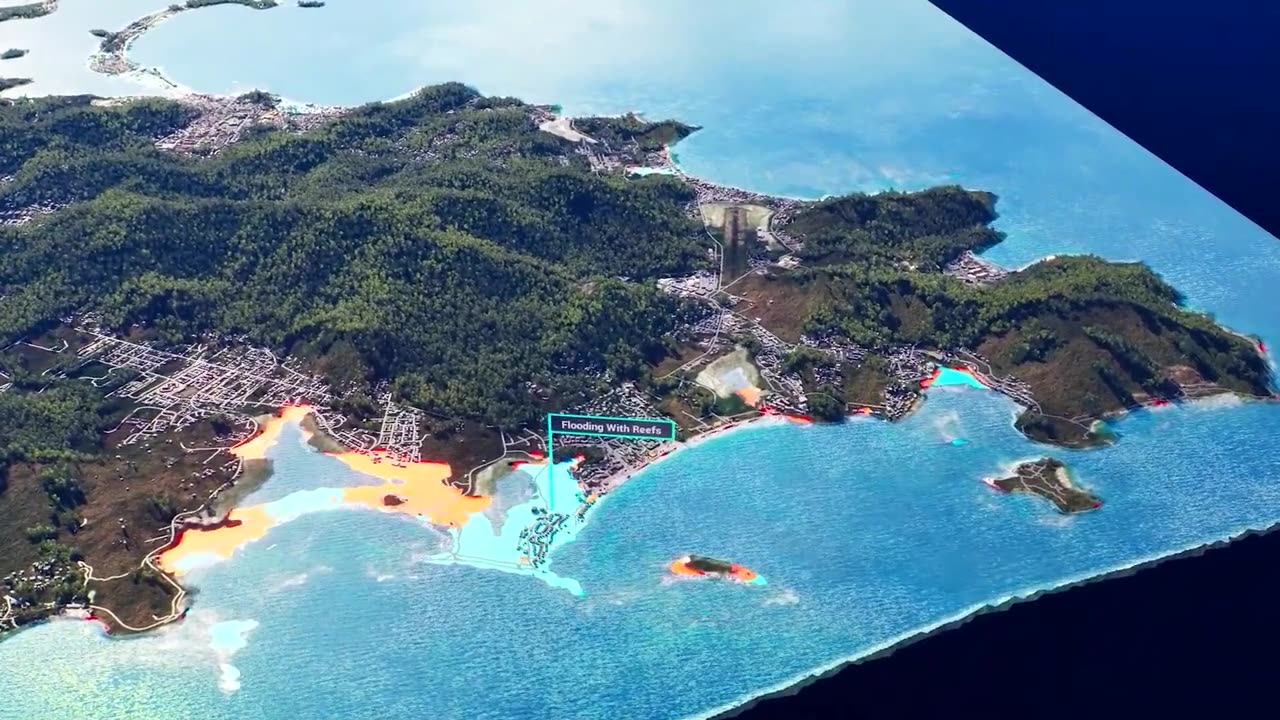
Maps how much flood damage reefs and mangroves prevent across Caribbean and Pacific island nations.
CoSMoS Adapts and CalWaves
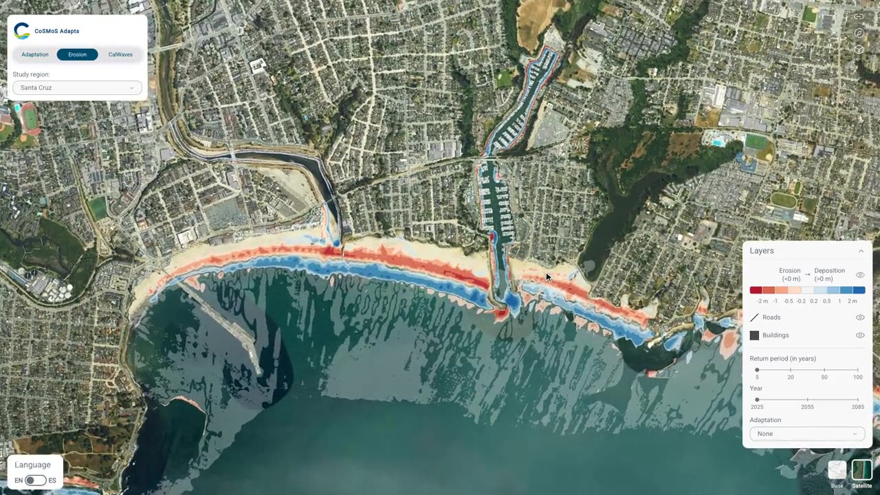
Flood, erosion, and adaptation scenarios for California coastal sites, plus the state's nearshore wave climate.
Technical Approach
A reusable annual-benefit model spans two tools
We built a damage model that combines open global building-footprint data with standard flood depth-damage curves, then integrates expected damage across storm return periods into one annual benefit value per habitat. We have adapted this model to run both globally and locally, under the direction of Dr. Borja Reguero.
Python · JRC depth-damage curves · DLR WSF3D
XBeach output made cloud-native for maps and analysis
CoSMoS Adapts' erosion results come from XBeach, a coastal storm model whose raw output is built for offline analysis, not the web. We converted it into range-readable Cloud-Optimized GeoTIFFs, so it streams fast for interactive maps and for analysis that reads only the area it needs.
XBeach · Cloud-Optimized GeoTIFF · Python
A global mangrove study became a public map
When the center valued global mangrove flood protection at $855 billion, we built the map that lets anyone explore those results by location instead of reading a paper. The same map now carries the center's World Bank-featured research directly to planners and the public.
Mapbox GL · WebGL
Results
- The reusable annual-benefit damage model now powers two separate CCCR tools.
- Rebuilt erosion rasters pass automated checks before every release, catching bad data before it ships.
- Coastal Resilience Explorer puts the center's $855 billion mangrove study, featured in the World Bank's Changing Wealth of Nations, in front of the public.
- California coastal planners in Santa Cruz, Ventura, and Half Moon Bay use the tools to compare adaptation scenarios.
Who uses it
Verra SD VISta Coastal Resilience methodology
Verra's methodology for coastal resilience assets values the same flood-protection benefits Coastal Resilience Explorer maps. The Nature Conservancy, IH Cantabria, and TerraCarbon developed it.
The World Bank
Featured the mangrove flood-protection values released through Coastal Resilience Explorer in The Changing Wealth of Nations 2024.
California State Coastal Conservancy
Funds the expansion of CoSMoS Adapts to Ventura, Los Angeles, and Orange counties.
California coastal planners
Santa Cruz, Ventura, and Half Moon Bay use CoSMoS Adapts to compare flood, erosion, and damage scenarios for local adaptation choices.
International Coral Reef Initiative
Hosted the UN Ocean Conference showcase where the NbS Adapts reef and mangrove visualizations were shown.
Workshops and events
Award · September 2026
California State Coastal Conservancy award for the CoSMoS Adapts South Coast expansion
The Conservancy board approved up to $1,500,143 for CoSMoS Adapts in Ventura, Los Angeles, and Orange counties, including new visualization and communication tools.
Conference · June 2025
In Nice, the center showed the NbS Adapts reef and mangrove flood-risk visualizations, the interactive site, and game-engine flood videos at a showcase hosted by the International Coral Reef Initiative.
Feature · December 2024
Global mangrove flood-protection study release
The center released its global study of mangrove flood protection and published the results and data through Coastal Resilience Explorer.