
Humanitarian Mapping with WFP
Amit Wadhwa, PRISM Global Programme Manager, World Food Programme
We build PRISM, the UN World Food Programme's open-source hazard-monitoring platform, deployed worldwide and built to work on low-bandwidth connections.
Problem Statement
WFP country offices need to see where climate hazards meet vulnerable communities, often in places with weak infrastructure and unreliable internet. Before PRISM, each country ran its own disconnected mapping setup, and full-resolution map layers required too much domain expertise. The program needed one platform that worked worldwide and stayed fast on a slow connection.
Collaboration
We work directly in PRISM's open-source codebase alongside WFP's Global Programme Manager Amit Wadhwa and the VAM team. We build the system that country offices and international partners rely on, one that streamlines climate-informed decision making.
Technical Approach
One global deployment replaces per-country apps
We built PRISM's first deployment to support global-scale datasets in a single app. Users start from a worldwide view and zoom into any country's detail, instead of switching between separate country-specific deployments, enabling country offices to quickly review regional trends.
MapLibre GL · PMTiles · GeoParquet
Cloud-native formats keep maps fast on weak connections
We added support for cloud-native geospatial formats: STAC catalogs, direct rendering of Cloud-Optimized GeoTIFFs, Zarr, and PMTiles. We put these technologies to use in high-impact decision-making situations.
STAC · Cloud-Optimized GeoTIFF · Zarr · PMTiles
Scheduled PDF maps reach inboxes with no login
We built a scheduled PDF generator that renders a customized map for each country office as soon as new hazard data lands, and delivers it straight to staff inboxes. Teams get the latest picture without logging in or loading large map layers themselves.
Results
- PRISM now runs as a single worldwide deployment instead of separate country builds.
- Cloud-native formats cut load times on low-bandwidth connections in the field.
- Country offices receive scheduled maps automatically, with no manual request.
- PRISM remains open source and deployed worldwide as a recognized digital public good.
Who uses it
WFP country offices worldwide
Combine satellite hazard data with vulnerability data in PRISM for disaster risk reduction and social protection planning.
National disaster and climate agencies
Partner agencies run their own PRISM instances, including Indonesia's BMKG, Mongolia's National Emergency Management Agency, and Cambodia's National Committee for Disaster Management.
Country deployments
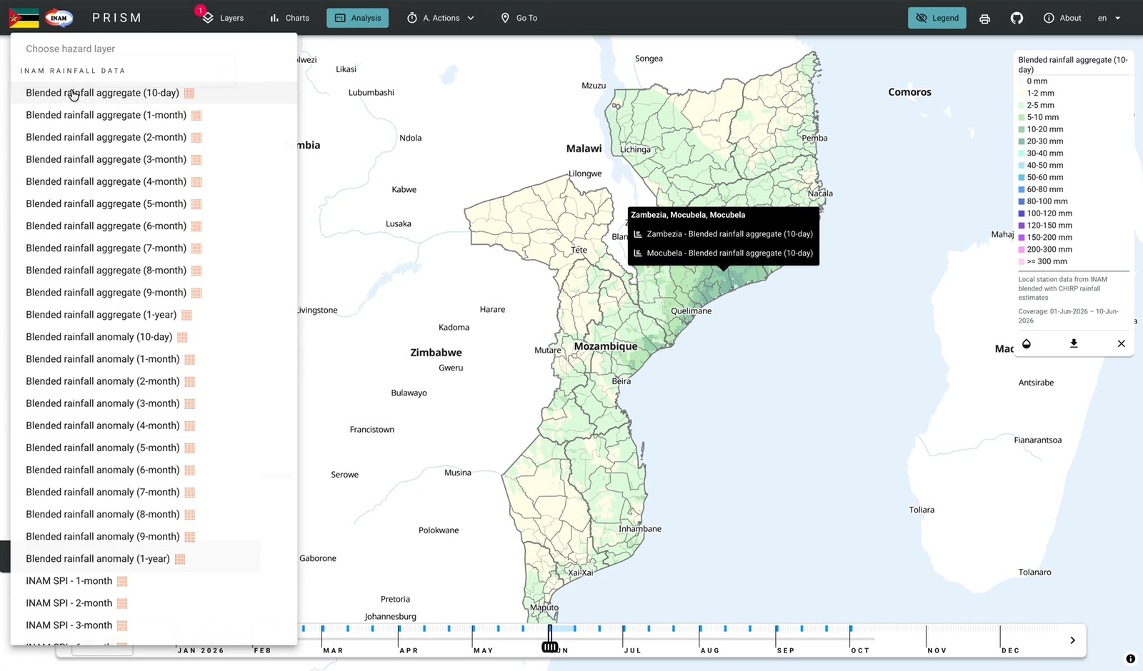
Public PRISM sites run for Mozambique, Malawi, Myanmar, Tanzania, Zambia, Zimbabwe, and Sri Lanka, with more country configurations in the open-source repo.
UN affiliates and humanitarian partners
WFP shares PRISM hazard and vulnerability information with humanitarian and development partners and with the public.